served from 45.183.221.150
min [ NOAA NOAA_OI_SSTv2_HRD SST_Anomalies anom ]: SST anomalies data
anom SST anomalies from NOAA NOAA_OI_SSTv2_HRD SST_Anomalies: ERSST.v5: Extended Reconstructed Sea Surface Temperature Dataset, Version 5..Independent Variables (Grids)
- latitude (latitude)
- grid: /lat (degree_north) ordered (89.875S) to (89.875N) by 0.25 N= 720 pts :grid
Other Info
- CE
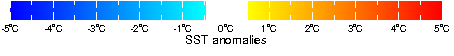
- 5.0
- colorscalename
- sst_color_anom
- CS
- -5.0
- datatype
- realarraytype
- file_missing_value
- -999.0
- iridl:hasSemantics
- iridl:SeaSurfaceTemperatureAnomaly
- maxncolor
- 254
- missing_value
- NaN
- pointwidth
- 1.0
- scale_max
- 5.0
- scale_min
- -5.0
- standard_name
- sea_surface_temperature
- units
- degree_Celsius
- valid_max
- 12.0
- valid_min
- -12.0
- standard units*
- degree_Kelvin
- history
- min over lon[0.125E, 0.125W] T[Jan 1981, Apr 2024]
- colorscale
References
Huang_etal2017Last updated: Wed, 22 May 2024 15:38:52 GMT
Expires: Sun, 02 Jun 2024 00:00:00 GMT
Data Views
| lat | |
| M |
|---|
Filters
Here are some filters that are useful for manipulating data. There are actually many more available, but they have to be entered manually. See Ingrid Function Documentation for more information.- Monthly Climatology calculates a monthly climatology by averaging over all years.
- anomalies calculates the difference between the (above) monthly climatology and the original data.
- Integrate along lat
- Differentiate along lat
- Take differences along lat
RMS (root mean square with mean *not* removed) over lat |
RMSA (root mean square with mean removed) over lat |
Maximum over lat |
Minimum over lat |
Detrend (best-fit-line) over lat |
Note on units